File:Wellington landsat labelled.jpg
Size of this preview: 800 × 593 pixels. Other resolutions: 320 × 237 pixels | 640 × 474 pixels | 1,024 × 758 pixels | 1,280 × 948 pixels.
Original file (1,280 × 948 pixels, file size: 206 KB, MIME type: image/jpeg)
| Description |
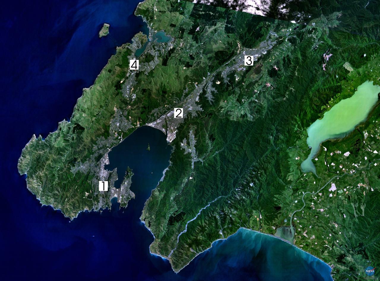
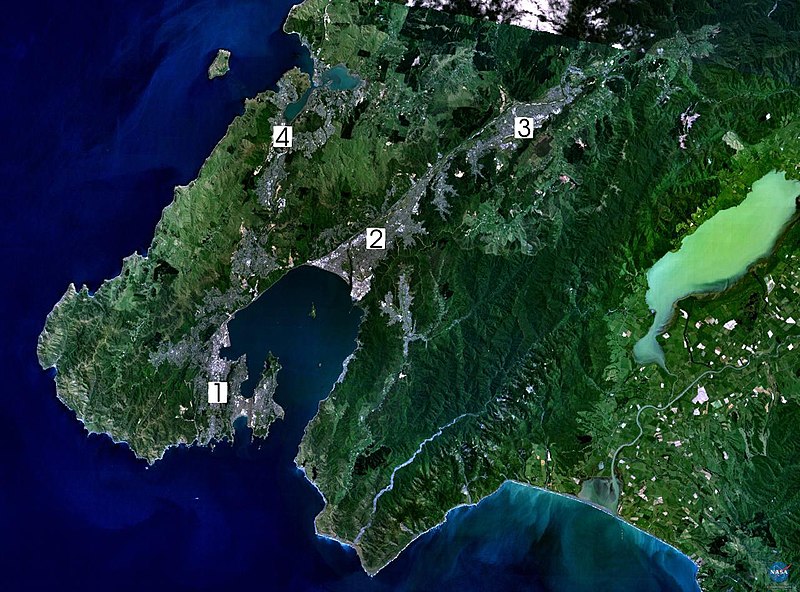
NASA World Wind composite landsat-7 satellite image of Wellington, New Zealand. (1) Central Wellington (2) Lower Hutt (3) Upper Hutt (4) Porirua. English: Satellite photo of the Wellington conurbation: (1) Wellington; (2) Lower Hutt; (3) Upper Hutt; (4) Porirua.
日本語: 人工衛星によるウェリントンの写真。1: ウェリントン、2: ロウワー・ハット (Lower Hutt)、3: アッパー・ハット (Upper Hutt)、4: ポリルア (Porirua)。以上の4市がウェリントン都市圏 (urban area) を構成する
Norsk bokmål: Satelittfoto av Wellingtonregionen. (1) Wellington (2) Lower Hutt (3) Upper Hutt (4) Porirua |
|||
| Source | en:wikipedia | |||
| Author | NASA, edited by en:User:Clawed | |||
| Permission (Reusing this file) |
|

File history
Click on a date/time to view the file as it appeared at that time.
| Date/Time | Thumbnail | Dimensions | User | Comment | |
|---|---|---|---|---|---|
| current | 16:34, 1 Hepetema 2005 | | 1,280 × 948 (206 KB) | Klipp~commonswiki | NASA World Wind composite landsat-7 satellite image of Wellington, New Zealand. (1) Central Wellington (2) Lower Hutt (3) Upper Hutt (4) Porirua. {{PD-USGov-NASA}} |
File usage
The following page uses this file:
Global file usage
The following other wikis use this file:
- Usage on ast.wikipedia.org
- Usage on ca.wikipedia.org
- Usage on da.wikipedia.org
- Usage on de.wikipedia.org
- Usage on el.wikipedia.org
- Usage on en.wikipedia.org
- Wellington Region
- Hutt Valley
- Lake Wairarapa
- Category:Wikipedians in New Zealand
- User:Ollieinc/Userboxes
- User:Ollieinc/Userboxes/Wider Wellington
- User:Ollieinc/Userboxes/hasWider Wellington
- Wikipedia:Wikipedians in New Zealand user boxes
- Wikipedia:Userboxes/Location/New Zealand
- User:Joseph Pelorus
- User:CatholicKiwi
- User:WG at Dole
- Usage on eo.wikipedia.org
- Usage on es.wikipedia.org
- Usage on fr.wikipedia.org
- Usage on gl.wikipedia.org
- Usage on hu.wikipedia.org
- Usage on ja.wikipedia.org
- Usage on nn.wikipedia.org
- Usage on no.wikipedia.org
- Usage on pl.wikipedia.org
- Usage on pt.wikipedia.org
- Usage on sv.wikipedia.org
- Usage on tr.wikipedia.org
- Usage on uk.wikipedia.org
- Usage on www.wikidata.org
- Usage on zh.wikipedia.org