File:Position of Southland Region.png
No higher resolution available.
Position_of_Southland_Region.png (405 × 590 pixels, file size: 7 KB, MIME type: image/png)
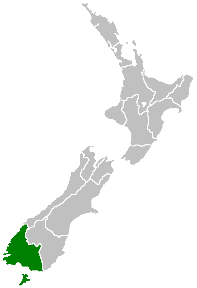
Region of New Zealand, position on the map (source:English Wiki)
| |
This work has been released into the public domain by its author, Furius, at the Ingarihi Wikipedia project. This applies worldwide. In case this is not legally possible: |
File history
Click on a date/time to view the file as it appeared at that time.
| Date/Time | Thumbnail | Dimensions | User | Comment | |
|---|---|---|---|---|---|
| current | 07:41, 27 Āperira 2005 | | 405 × 590 (7 KB) | Domie~commonswiki | Region of New Zealand, position on the map (source:English Wiki) {{PD}} Category:Maps of New Zealand |
File usage
More than 100 pages use this file. The following list shows the first 100 pages that use this file only. A full list is available.
- Aparima
- Athol
- Avondale
- Bayswater
- Birchwood
- Blackmount
- Branxholme
- Browns
- Caroline
- Cascade Creek
- Castlerock
- Centre Bush
- Clifden
- Crawfords
- Cromarty
- Dipton
- Drummond
- Dunearn
- Eastern Bush
- Ermedale
- Fairfax
- Feldwick
- Five Rivers
- Five Roads
- Gladfield
- Glenure
- Gropers Bush
- Gummies Bush
- Hazletts
- Heddon Bush
- Heenans Corner
- Hokonui
- Isla Bank
- Josephville
- Kauana
- Kennington
- Kilbride
- Lady Barkly
- Limehills
- Lintley
- Longridge North
- Longwood
- Lorneville
- Lowther
- Mabel Bush
- Makarewa
- Makarewa Junction
- Merrivale
- Mill Road
- Monowai
- Myross Bush
- New Windsor
- Opio
- Oporo
- Orepuki
- Oreti Plains
- Otahu Flat
- Otapiri
- Otapiri Gorge
- Pahia
- Papatotara
- Parawa
- Piko Piko
- Port Craig
- Pourakino Valley
- Pukemaori
- Pukemutu
- Rakahouka
- Raymonds Gap
- Ringway
- Roslyn Bush
- Ryal Bush
- Sandstone
- Scotts Gap
- South Hillend
- Spar Bush
- St Patricks
- Taramea Bay
- Taramoa
- Te Oneroa
- Te Tua
- Te Waewae
- The Key
- The Rocks
- Thornbury
- Tinkertown
- Waianiwa
- Waihoaka
- Waihōpai
- Waikouro
- Waimatuku
- Waipango
- Wairio
- Wakapatu
- West Plains
- Wilsons Crossing
- Woodlaw
- Wreys Bush
- Wrights Bush
- Ōrauwea
View more links to this file.
Global file usage
The following other wikis use this file:
- Usage on en.wikipedia.org
- Pearl Harbour, New Zealand
- Halfmoon Bay (Stewart Island)
- Mavora Lakes
- Mount Anglem
- Te Waewae Bay
- Toetoes Bay
- Oreti Beach
- South Cape / Whiore
- Anchorage Island (New Zealand)
- Gore Aerodrome
- Waipapa Point
- Mount Pye (New Zealand)
- Porpoise Bay (New Zealand)
- Drummond, New Zealand
- Template:Southland-geo-stub
- Browns, New Zealand
- Springhills
- Rakahouka
- Longbush, Southland
- Roslyn Bush
- Glencoe, New Zealand
- Waitane
- Te Tipua
- Birchwood, New Zealand
- Murihiku
- Anderson Park, Invercargill
- Great South Basin
- Waimatuku
- Pukewao
- Te Peka
- Fortification, New Zealand
- Titiroa
- Pine Bush, New Zealand
- Kapuka South
- Oteramika
- Timpanys
- Waikawa, Southland
- White Hill Wind Farm
- Lorneville, New Zealand
- Rakatu Wetlands
- Kepler Mire
- Mount Allen, Stewart Island
- Wallace County, New Zealand
- Big Bay (New Zealand)
- Clifden Limestone Caves
- Raratoka Island
- Longwood Range
- Waimea Plain (Southland)
- Waituna Lagoon
- Lake Henry (New Zealand)
View more global usage of this file.