File:Luxembourg Fortress from Adolphe Bridge 02 c67.jpg
Size of this preview: 800 × 532 pixels. Other resolutions: 320 × 213 pixels | 640 × 426 pixels | 1,024 × 681 pixels | 1,280 × 852 pixels | 2,560 × 1,703 pixels | 4,256 × 2,832 pixels.
Original file (4,256 × 2,832 pixels, file size: 8.02 MB, MIME type: image/jpeg)
Summary
| Description |
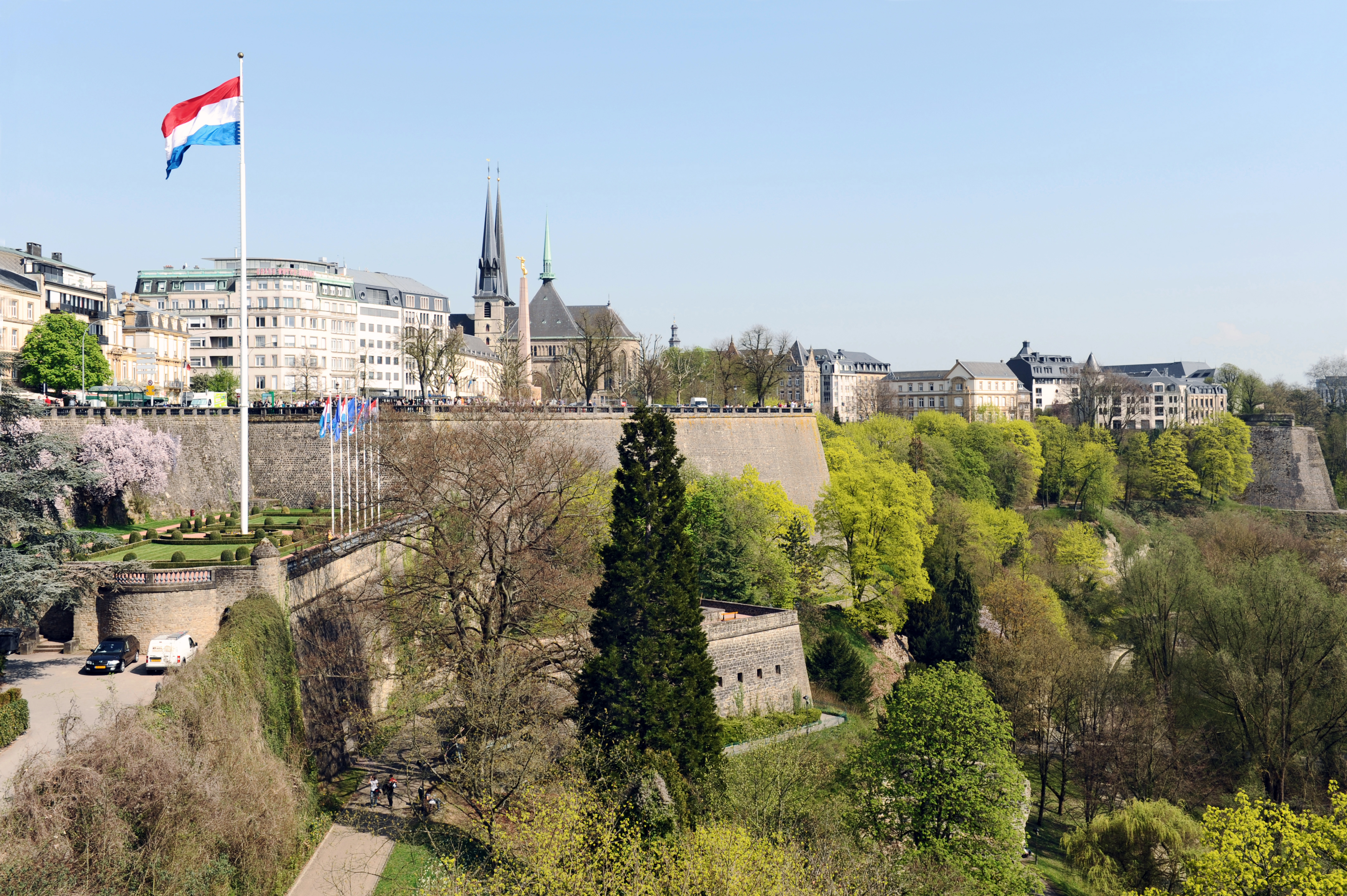
English: Luxembourg City: Fortress with Bastion Beck, Monument du souvenir (Gëlle Fra) and Petrusse valley. Seen from Adolphe Bridge. |
| Date | |
| Source | Own work |
| Author | Cayambe |
| Camera location | | View this and other nearby images on: OpenStreetMap |
|---|
Licensing
I, the copyright holder of this work, hereby publish it under the following licenses:
This file is licensed under the Creative Commons Attribution-Share Alike 3.0 Unported license.
- You are free:
- to share – to copy, distribute and transmit the work
- to remix – to adapt the work
- Under the following conditions:
- attribution – You must give appropriate credit, provide a link to the license, and indicate if changes were made. You may do so in any reasonable manner, but not in any way that suggests the licensor endorses you or your use.
- share alike – If you remix, transform, or build upon the material, you must distribute your contributions under the same or compatible license as the original.

|
Permission is granted to copy, distribute and/or modify this document under the terms of the GNU Free Documentation License, Version 1.2 or any later version published by the Free Software Foundation; with no Invariant Sections, no Front-Cover Texts, and no Back-Cover Texts. A copy of the license is included in the section entitled GNU Free Documentation License. |
You may select the license of your choice.
This image has been assessed using the Quality image guidelines and is considered a Quality image.
|
| Annotations | This image is annotated: View the annotations at Commons |
File history
Click on a date/time to view the file as it appeared at that time.
| Date/Time | Thumbnail | Dimensions | User | Comment | |
|---|---|---|---|---|---|
| current | 08:30, 1 Oketopa 2009 | | 4,256 × 2,832 (8.02 MB) | Cayambe | |
| 09:27, 14 Hepetema 2009 |  | 4,256 × 2,832 (7.76 MB) | Cayambe | ||
| 08:24, 14 Hūrae 2009 |  | 4,256 × 2,832 (7.7 MB) | Cayambe | {{Information |Description={{en|1=Luxembourg City: Fortress with Bastion Beck, Monument du souvenir (Gëlle Fra) and the Petrusse valley in spring. Seen from Adolphe Bridge. April 2009.}} |Source=Own work |Author=Cayambe |Date=2009-04-10 |
File usage
The following page uses this file:
Global file usage
The following other wikis use this file:
- Usage on ar.wikipedia.org
- Usage on br.wikipedia.org
- Usage on ckb.wikipedia.org
- Usage on de.wikipedia.org
- Usage on eo.wikipedia.org
- Usage on es.wikipedia.org
- Usage on fr.wikipedia.org
- Usage on gv.wikipedia.org
- Usage on hu.wikipedia.org
- Usage on id.wikipedia.org
- Usage on io.wikipedia.org
- Usage on ja.wikipedia.org
- Usage on lb.wikipedia.org
- Usage on lt.wikipedia.org
- Usage on mk.wikipedia.org
- Usage on sk.wikipedia.org