File:Illustrerad Verldshistoria band I karta 4.jpg
Size of this preview: 800 × 482 pixels. Other resolutions: 320 × 193 pixels | 640 × 386 pixels | 1,024 × 617 pixels | 1,280 × 771 pixels | 2,560 × 1,542 pixels | 4,729 × 2,849 pixels.
Original file (4,729 × 2,849 pixels, file size: 4.77 MB, MIME type: image/jpeg)
| Description |
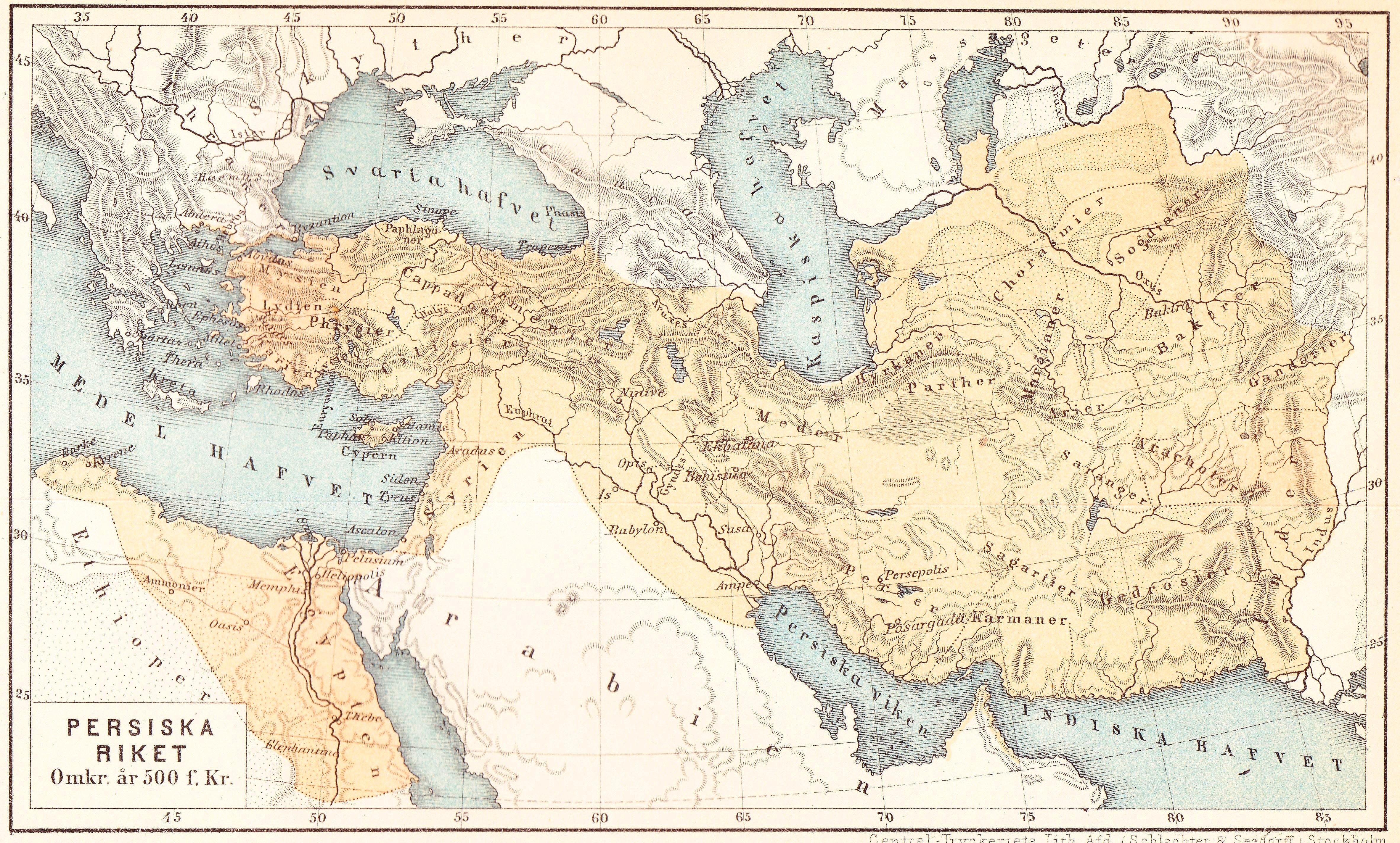
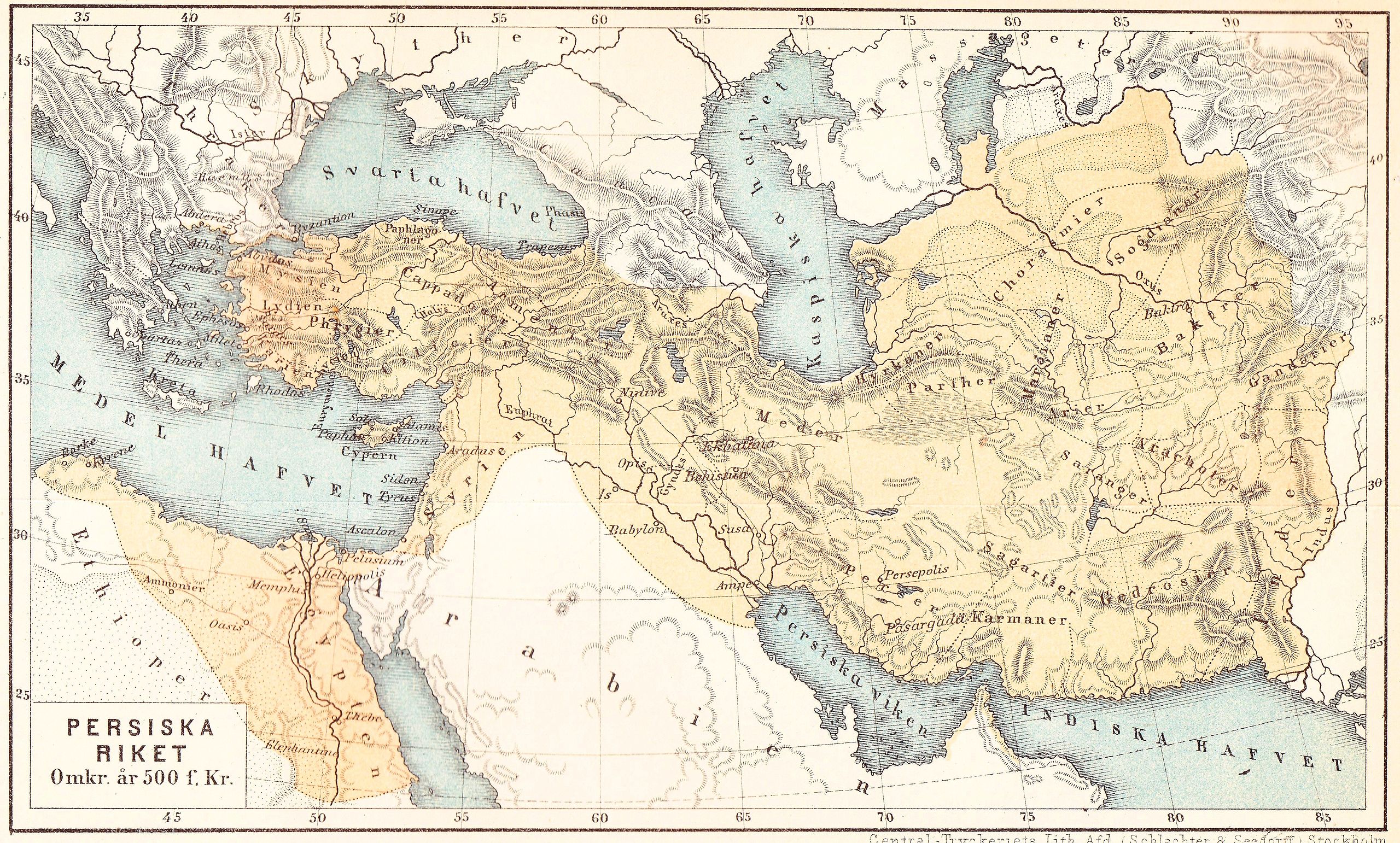
Svenska: Karta från "Illustrerad verldshistoria utgifven av E. Wallis. band I" Persiska riket 500 f Kr.
English: Map from "Illustrerad verldshistoria utgifven av E. Wallis. volume I": The Achaemenid Empire, 500 BC. |
|||||
| Date | ||||||
| Source | own scan | |||||
| Author | Ernst Wallis et al | |||||
| Permission (Reusing this file) |
|

File history
Click on a date/time to view the file as it appeared at that time.
| Date/Time | Thumbnail | Dimensions | User | Comment | |
|---|---|---|---|---|---|
| current | 15:05, 9 Hune 2010 | | 4,729 × 2,849 (4.77 MB) | Lavallen | {{Information |Description={{sv|Karta från "Illustrerad verldshistoria utgifven av E. Wallis. band I" ''Persiska riket 500 f Kr.''}} {{en|Map from "Illustrerad verldshistoria utgifven av E. Wallis. volume I": ''The Achaemenid Empire, 500 BC.''}} |Source= |
File usage
The following page uses this file:
Global file usage
The following other wikis use this file:
- Usage on en.wikipedia.org
- Usage on sr.wikipedia.org
- Usage on sv.wikipedia.org