File:Baltic Sea map.png

Size of this preview: 560 × 599 pixels. Other resolutions: 224 × 240 pixels | 448 × 480 pixels | 718 × 768 pixels | 957 × 1,024 pixels | 1,493 × 1,598 pixels.
Original file (1,493 × 1,598 pixels, file size: 655 KB, MIME type: image/png)
Summary
| Description |
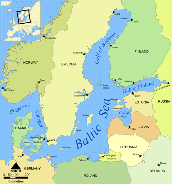
English: Map of the Baltic Sea. |
| Date | |
| Source | Own work (Created by NormanEinstein) |
| Author | NormanEinstein |
| Other versions |
[]
|


Licensing
NormanEinstein, the copyright holder of this work, hereby publishes it under the following license:

|
Permission is granted to copy, distribute and/or modify this document under the terms of the GNU Free Documentation License, Version 1.2 or any later version published by the Free Software Foundation; with no Invariant Sections, no Front-Cover Texts, and no Back-Cover Texts. A copy of the license is included in the section entitled GNU Free Documentation License. |
| This file is licensed under the Creative Commons Attribution-Share Alike 3.0 Unported license. | ||
| Attribution: NormanEinstein | ||
| ||
| This licensing tag was added to this file as part of the GFDL licensing update. |
Derivative works
Derivative works of this file:
- Baltic Sea map-sv.png
- Baltic Sea map2.png
- Baltic Sea map3.png
- Baltic Sea map hr.svg
- Baltic Sea map2 hr.svg
- Mar Baltico mappa.jpg
- Baltic Sea map Urdu.svg
- Baltic Sea map Usedom location.png
- Baltic Sea map cy PNG.png
File history
Click on a date/time to view the file as it appeared at that time.
| Date/Time | Thumbnail | Dimensions | User | Comment | |
|---|---|---|---|---|---|
| current | 12:45, 6 Hune 2022 | | 1,493 × 1,598 (655 KB) | 野良人 | opt |
| 12:33, 7 Mei 2012 |  | 1,493 × 1,598 (672 KB) | Ras67 | cropped, opt. | |
| 12:04, 1 Oketopa 2008 |  | 1,500 × 1,606 (804 KB) | Salleman~commonswiki | added dots to Malmö and a ring to Luleå as per Åland, Öland and Rügen having their diacritics | |
| 15:47, 25 Mei 2006 |  | 1,500 × 1,606 (803 KB) | NormanEinstein | Map of the Baltic Sea. Created by NormanEinstein, May 25, 2006. {{GFDL-self}} Category:Maps of seas |
File usage
The following page uses this file:
Global file usage
The following other wikis use this file:
- Usage on af.wikipedia.org
- Usage on am.wikipedia.org
- Usage on anp.wikipedia.org
- Usage on an.wikipedia.org
- Usage on ar.wikipedia.org
- Usage on ast.wikipedia.org
- Usage on as.wikipedia.org
- Usage on awa.wikipedia.org
- Usage on azb.wikipedia.org
- Usage on az.wiktionary.org
- Usage on ban.wikipedia.org
- Usage on ba.wikipedia.org
- Usage on bg.wikipedia.org
- Usage on bh.wikipedia.org
- Usage on bn.wikipedia.org
- Usage on bs.wikipedia.org
- Usage on ca.wikipedia.org
- Usage on ckb.wikipedia.org
- Usage on crh.wikipedia.org
- Usage on cs.wikipedia.org
- Usage on cv.wikipedia.org
- Usage on cy.wikipedia.org
- Usage on da.wikipedia.org
- Usage on dsb.wikipedia.org
- Usage on el.wikipedia.org
- Usage on el.wiktionary.org
- Usage on en.wikipedia.org
- Lockheed SR-71 Blackbird
- Gulf of Bothnia
- Baltic region
- Category:Baltic Sea
- User:NormanEinstein/gallery
- Wikipedia:Userboxes/Location
- Portal:Estonia/Featured article/2006 archive
- Portal:Estonia/Featured article/August 2006
- User:Buaidh
- Wikipedia:Userboxes/Travel
- Portal:Estonia/Selected article
- Portal:Estonia/Selected article/2
- Ocean fisheries
- Category:Fish of the Baltic Sea
View more global usage of this file.